F – HISTORIC PORT MORRIS GANTRIES
PennDesign Bronx Biolab
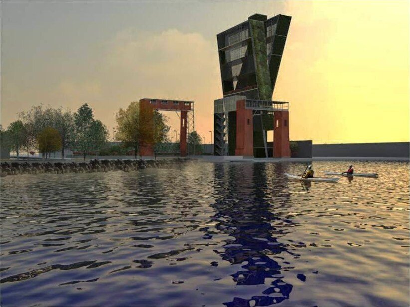
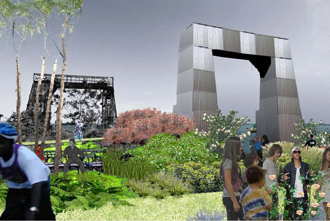
This site is located between East 134th Street and East 135th Street at the East River. The Historic Port Morris Gantries were recognized by the Historic Districts Council during its “Six to Celebrate” program which identified projects on the basis of the architectural and historic merit of the area, the level of threat to the neighborhood, the strength and willingness of the local advocates and the potential for HDC’s preservation support to be meaningful.
At roughly four stories tall, the Port Morris Gantries stand as a reminder of New York City’s rich nautical heritage. Prior to the construction of bridges in the early 20th century, passengers and goods were transported by ferry services operating from slips on the waterfront. The 134th Street ferry slip was established in 1902 by the New York and College Point Ferry Company, which had been operating ferries across the East River from various points since 1886. To capitalize on Port Morris’ inclusion in a network of communities serviced by ferry, a market, hotels, restaurants, and stables were constructed nearby in 1905.
With the advance of railroad, subway, and highway infrastructure, the necessity of ferry service declined and many companies went out of business. The New York and College Point Ferry Company went out of business in 1918, though not entirely due to its obsolescence. George Ehret, Sr., the company’s founder, was understood to have been a financial supporter of German causes and was in Germany at the onset of World War I. As a result of his decision to stay there, the United States government considered him an enemy alien and seized his assets, including the ferry company.
From that point, the city controlled ferry operations from the site for transportation to city institutions located on Rikers, Welfare, and North Brother Islands. In 1948, North Brother became home to Riverside Emergency Housing for World War II veterans and their families. To accommodate this new island traffic, the city upgraded the 134th Street ferry facility and constructed the ferry bridges that same year. The ferry bridges functioned as gangways to load passengers and vehicles onto the ferry boats and absorb some of the impact of boats entering the slip. In 1966, the ferry was discontinued and the Police Department began using the site as a marina. A one-story brick building was constructed for the Harbor Unit headquarters. Today the site is still owned by the city but has been mostly unused since the 1990s.
The site acquisition would enable a public green space at the Port Morris Gantries site and is consistent with the recognition given to the space as a priority area in Vision 2020 NYC Comprehensive Waterfront Plan, and the site is also included in the NYC Parks Department Harlem River Watershed and Natural Resources Management Plan for the Bronx. Finally, this coastal site is also important because it is located in a Zone B flood zone and was impacted by Hurricane Sandy with a significant water surge because of its location off of the Long Island Sound. Given its close proximity to power stations, this proposal would serve to offset the effects of waterfront storm surges on the power grid.


